Our story

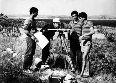
The Geodetic Office of Mataija was founded in 1991, under the leadership of Dragutin Mataija, a graduate engineer in geodesy. We provide geodetic services related to the construction of settlements and infrastructure (planning and staking out), related to the real estate cadastre and land register, as well as cadastre installations and others. Our office currently employs 10 employees, most of whom are geodesy engineers. The office is equipped with the latest measuring instruments and the necessary hardware and software for processing measurement data.

Trust the numbers

2

OFFICES

10

EMPLOYEES

30+

YEARS OF EXPERIENCE

500+

PROJECTPER YEAR

Office Umag

The office is located in the village of Barboj, located on the road from Umag to the tourist village of Kanegra, 5 km from Umag and 12 km from Buje. The office is located in 110 m² of space.

Office Novigrad

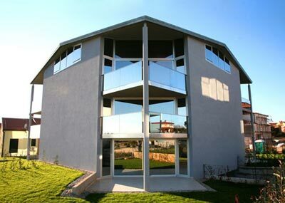
The Novigrad office is located in the newly built Vidal settlement, located on the Buje - Novigrad road. We are only 1 km from the city center.

Services

Professional surveying intended for the maintenance ofland and real propertycadastres (on-site surveyingand data collection, includingallotment and othersurveysintended forthe land cadastre maintenance, surveysintended for the real property cadastre maintenance, and surveysfor individualtransferof cadastral plot data from the land cadastre into the real property cadastre).

Professional surveying intended for the infrastructure cadastre.

Professional surveying services intended for natural and legal persons.

Professional surveyingfor spatial planningpurposes (preparation of survey mapsfor the drawing up of spatial planning documents and acts, and other surveying services for spatial planning purposes).

Professional surveyingfor construction purposes (preparation of survey maps for building design purposes; preparation ofsurvey sketches of actual site layout prior to construction;preparation of surveying projects;construction stakeout services and survey reports; as-built, final and monitoring surveys, including relevant survey reports;and survey supervision services).

Professional aerial surveying (flight planning, aerial surveys, processing of collected imagery and videos, and development of survey maps on the basis of aerial surveys).

Professional surveying to producean accurate representation of space in the coordinate reference system of the Republic of Croatia.

Geographic information services aimed at standardising spatial data and/or transferring them into the coordinate reference system of the Republic of Croatia 

Collating spatial data based on official geospatial and real property records

Note: We procure the necessary documentation for the preparation of the report on behalf of the party for the work in question (certified copies of the cadastral plan, extract from the land register, title deed...)

Useful links